本文
Nankai Trough Earthquake / 南海トラフ地震
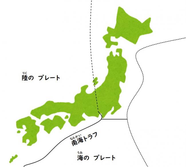
南海トラフ
- 海の プレート(フィリピン海の プレート)…土佐湾から 日向灘沖まで
- 陸の プレート(ユーラシア大陸の プレート)…駿河湾から 紀伊半島までの 南側
2つの プレートが ぶつかるところが あります。
ぶつかったところに 海の 底に 溝が あります。
そこを 「南海トラフ」と いいます。
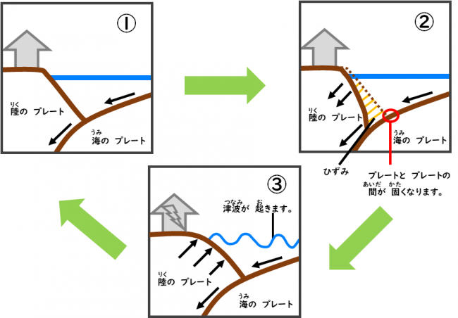
南海トラフ地震が 起きるしくみ
- フィリピン海の プレートが ユーラシア大陸の プレートの 下に 入ります。
- プレートと プレートの 間が 固く なります。
陸の プレートが 下に 引っ張られます。ひずみが できます。 - 陸の プレートが 上に はねあがると 地震が 起きます。
1→2→3を 繰り返すと、地震が 何回も 起きます。
地震に 備えます
大きい地震や 津波が 起きるかもしれません。
市の ホームページを 見てください。
- Multilingual Weather and Disaster Information / 天気・災害〈地震・台風など〉
- Earthquake Preparedness /地震が 来る前に すること
- Evacuation Site (Earthquake/Tsunami)/ 避難所〈にげるところ〉(地震・津波)
問い合わせ
危機管理課
電話 04-7093-7833
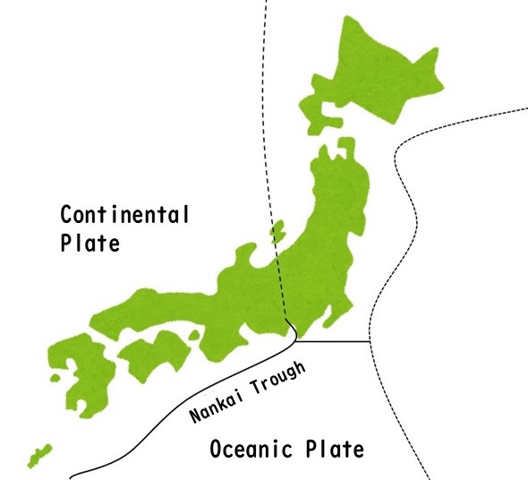
Nankai Trough
- Oceanic Plate(Philippine Sea Plate)…From Tosa Bay to off Hyuga-nada Sea
- Continental Plate(Eurasian Plate)…South from Suruga Bay to Kii Peninsula
The Nankai Trough is a long hollow, like a trench in the bottom of the sea that is caused by the two plates intersecting or bumping with each other.
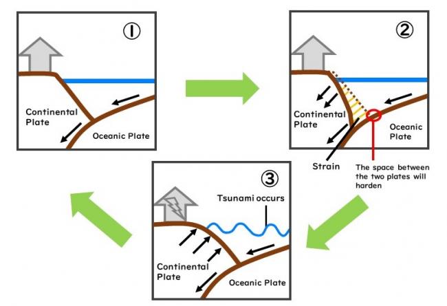
Nankai Trough Earthquake occurrence
- The Philippine Sea Plate sneaks into the Eurasian Plate.
- The space between the two plates will become hard.
The continental plate is pulled downwards and a strain is created. - Earthquake occurs when the continental plate rises upwards.
Earthquake occurs everytime the cycle is repeated.
Earthquake Preparedness
Huge Earthquakes and Tsunamis may occur.
Please check out the City Homepage for information.
- Multilingual Weather and Disaster Information / 天気・災害〈地震・台風など〉
- Earthquake Preparedness /地震が 来る前に すること
- Evacuation Site (Earthquake/Tsunami)/ 避難所〈にげるところ〉(地震・津波)
Questions
Disaster Management Division
Tel. 04-7093-7833


